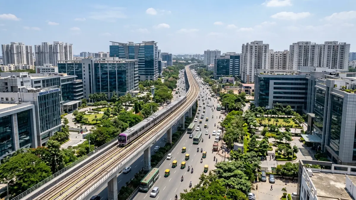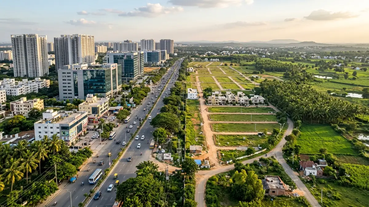
Sarjapur Road and Sarjapur Town share a name, but they are entirely different markets. Sarjapur Road is an urban employment corridor running from the Outer Ring Road to Kodathi, dominated by multi-storey apartments with a 15 to 35-minute commute to Bellandur tech parks. Sarjapur Town is a peripheral settlement 15 kilometres further east, governed by Gram Panchayats and BMRDA rules, built around plotted developments and gated villas where daily peak-hour commutes to the ORR stretch past an hour.
Disclosure: acre&key's advice is free to buyers. We're an authorised sales partner for some projects and may be paid by the developer.
If you spend five minutes looking at real estate portals in south-east Bengaluru, almost everything east of Bellandur gets stamped with the word "Sarjapur." A high-rise flat two kilometres from the Outer Ring Road is described as Sarjapur Road. A villa plot past the Tamil Nadu border is also marketed as Sarjapur.
For someone moving to the city or house-hunting for the first time, it is easy to assume they are just different stretches of the same neighbourhood. They are not.
The inner corridor and the outer town differ in almost every way that matters day to day: how long you spend in traffic, which municipal body inspects your building plan, whether you get piped utility water, and how your ownership is tracked in government records.
Here is what is actually happening on the ground between these two markets, and how to tell them apart before putting down a deposit.
The 7 Differences at a Glance
| Factor | Sarjapur Road Corridor | Sarjapur Town & Periphery |
|---|---|---|
| Physical Reach | Iblur / Agara Junction through Bellandur Gate, Doddakannelli, Carmelaram, and Kodathi (roughly 10–12 km) | Dommasandra Circle outward through Sompura, Yamare, Sarjapur Town, and the Attibele/Bagalur border |
| Governing Authority | BBMP / Greater Bengaluru Authority (Mahadevapura and Bommanahalli zones) | Local Gram Panchayats under Anekal Taluk (Sarjapur, Sompura, Mugalur) |
| Planning & Sanctions | Bangalore Development Authority (BDA) / Online BPAMS sanctions | Bangalore Metropolitan Region Development Authority (BMRDA) / Anekal Local Planning Authority (APA) |
| Ownership Document | Digital Final A-Khata on the e-Aasthi portal | Digital e-Swathu record (Form 9 & Form 11A for approved layouts) |
| Dominant Housing Type | Multi-storey apartment communities (2, 3, and 4 BHK towers) | Gated villa enclaves, plotted layouts, row houses, and standalone parcels |
| Water Supply Reality | BWSSB Cauvery network (Stages 4 & 5 distribution lines) supplemented by tankers | On-site borewells, private water tanker fleets, and village panchayat supply |
| Peak Commute to Bellandur ORR | 15 to 35 minutes depending on junction signals | 50 to 80+ minutes through Dommasandra and Carmelaram choke points |
1. The Geographic Divide: Where Does the Corridor End?
The confusion begins because Sarjapur Road is a long, continuous physical spine connecting core Bengaluru to an old trading town. But functionally, it breaks into three distinct zones:
[Iblur Junction (0 km)]
       │
       ▼ (Urban High-Rise Belt)
[Doddakannelli / Wipro SEZ (6 km)]
       │
       ▼
[Carmelaram Station (8 km)]
       │
       ▼
[Kodathi Gate (11 km)]
       │
       ▼ (THE CHOKE POINT — Municipal BBMP boundary ends)
[Dommasandra Circle (14 km)]
       │
       ▼ (Peri-Urban / Gated Layouts Belt)
[Sompura Gate (17 km)]
       │
       ▼
[Sarjapur Town (22 km)]
       │
       ▼ (STRR / State Border Node)
[Attibele / Bagalur Border (28 km)]
The Inner & Mid Corridor (Iblur to Kodathi)
Starting at the Outer Ring Road junction at Iblur, this 10-to-12-kilometre stretch runs through Kaikondrahalli, Doddakannelli, Carmelaram, and Kodathi. It is dense, intensely commercial, and anchored by major IT campuses like RMZ Ecoworld access roads, RGA Tech Park, and the Wipro SEZ. The surrounding streets are lined with supermarkets, preschools, multi-specialty hospitals, and high-density apartment communities.
The Choke Point (Dommasandra Circle)
Past Kodathi, you reach Dommasandra Circle. This junction acts as the psychological and physical boundary. Here, the four-lane urban road narrows, and traffic from Varthur and Gunjur merges with the main Sarjapur spine. During morning school runs and evening office hours, this circle is one of south-east Bengaluru's most stubborn bottlenecks. It is also where municipal city governance ends and rural Anekal Taluk panchayats take over.
The Outer Town & Fringe (Sompura to Sarjapur Town)
Once you clear Dommasandra, the landscape changes. High-rise glass towers give way to nursery farms, hardware stockyards, and gated plotted layouts branching into interior village roads. Sarjapur Town itself sits roughly 20 to 25 kilometres from the ORR junction. It is an established taluk center that connects south toward Attibele (leading to Electronic City and the Hosur highway) and east toward Bagalur.
When a builder brochure lists an address simply as "Sarjapur," check where the project gate actually sits along this sequence. If it is past Dommasandra, you are looking at an outer town property, not a corridor flat.
2. The Commute Differential: Destination by Destination
Travel fatigue depends heavily on where you need to report every morning. Here is how the two markets compare across Bengaluru's primary employment destinations:
| Workplace Destination | From Sarjapur Road Corridor (Carmelaram / Kodathi) | From Sarjapur Town (Central Hub) | Distance & Travel Dynamics | Practical Commute Verdict |
|---|---|---|---|---|
| Bellandur / ORR Tech Parks (Ecoworld, TechVillage, Prestige Tech Park) |
15 to 35 min (4 to 9 km) |
60 to 80+ min (20 to 26 km) |
+16 km / +45 min extra each way via Dommasandra Circle & Carmelaram rail gate. | Corridor wins decisively. Daily round-trip from the town means losing 2.5+ hours in traffic across chronic choke points. |
| Electronic City (Phase 1 Tech Hub & Phase 2) |
35 to 55 min (14 to 18 km) |
35 to 45 min (16 to 20 km) |
Town connects south via Attibele / Chandapura Road; Corridor relies on narrow Jail / Hosa Road links. | Sarjapur Town is faster & cleaner. Heading south avoids the choked Outer Ring Road spine entirely. |
| Whitefield / ITPL (ITPL, EPIP Zone, Kadugodi) |
35 to 50 min (12 to 16 km) |
50 to 70 min (22 to 27 km) |
Both routes face single-lane stretches around Varthur / Gunjur, but corridor offers alternate bypasses. | Corridor holds the edge. Town commute is viable only with off-peak or hybrid flexibility. |
| Kempegowda Airport (BLR) (Terminal 1 & Terminal 2) |
60 to 80 min (50 to 55 km) |
70 to 90 min (58 to 64 km) |
Town leverages STRR (NH-948A) expressway to Hoskote / Devanahalli without entering city traffic. | STRR narrows the gap. Town bypasses central bottlenecks; corridor relies on crowded SH-35 / Budigere Cross. |
The Door-to-Desk Rule: Never judge the commute on a Sunday site visit. Drive the exact route from the project gate to your office on a rainy Tuesday or Thursday morning at 8:30 AM before making any financial commitment.
3. The Price Illusion: Why a Town Villa Costs Less than a Corridor Flat
The primary reason buyers get confused by the name "Sarjapur" is sticker shock.
A buyer looking at a 3BHK apartment along the inner Sarjapur Road corridor might see quotes between ₹1.6 Crore and ₹2.4 Crore. Then they see an advertisement for a "3BHK Gated Villa on Sarjapur Road" priced at ₹1.2 Crore.
It feels like an incredible bargain—until they visit the site and realise the project is 14 kilometres past Dommasandra in a peripheral panchayat village.
Why Does the Price Gap Exist?
- Underlying Land Cost: Land along the inner municipal corridor commands urban commercial guidance values driven by walking-distance tech park demand. Farmland in peripheral panchayats carries agricultural guidance baselines that are a fraction of city prices.
- Infrastructure Costs: City apartments pay high municipal betterment charges, BWSSB water and sanitary connection levies, and underground utility cess. Peripheral layouts build their own roads, rely on septic tanks or local STP setups, and sink private borewells.
- The Commute Trade-off: The discount you see in Sarjapur Town is not developer generosity; it is the market pricing in 90 to 120 minutes of daily commute friction to central Bengaluru.
4. Civic Administration: BBMP e-Khata vs Panchayat e-Swathu
Your property's governing authority directly dictates your property tax portal, building plan permissions, utility sanction, and future resale paperwork.
The Corridor: BBMP / Greater Bengaluru Authority
The inner corridor falls under municipal wards managed by the Bruhat Bengaluru Mahanagara Palike (BBMP) within the Mahadevapura and Bommanahalli zones (now transitioning under the unified Greater Bengaluru Authority structure). - Plan sanctions for apartment buildings are granted through the online Building Plan Approval Management System (BPAMS). - Ownership records are tracked digitally on the e-Aasthi portal, issuing a Final A-Khata with an assigned Property Identification (PID) number. - Sale deed registration at the sub-registrar office via Kaveri 2.0 requires a verified Final e-Khata certificate.
The Town: Gram Panchayats & e-Swathu
Sarjapur Town, Sompura, Yamare, and surrounding hamlets fall outside municipal city limits. They are administered by local Gram Panchayats under the rural development framework: - The property ledger is maintained on the Karnataka government's e-Swathu database, not e-Aasthi. - In a legally sanctioned layout, each plot or villa receives Form 9 (village site sanction) and Form 11A (tax register extract). - The Form 11B trap: If an unapproved revenue layout has been carved out of farmland without formal planning sanction, the local panchayat issues a Form 11B. Under Karnataka land regulations, Form 11B is solely a tax collection record; it carries zero planning legitimacy, cannot receive formal building sanction, and nationalised banks generally reject loan applications against it.
5. Planning Authorities: BDA vs BMRDA and Anekal LPA
One of the most persistent marketing myths in fringe real estate is that a "panchayat approved" layout is all you need.
- Panchayats Cannot Sanction Layouts: A village panchayat has no statutory authority under the Karnataka Town and Country Planning Act (KTCP) to approve a multi-acre residential plotted development or a villa layout.
- The Real Authority in Sarjapur Town is BMRDA / APA: Land planning in Sarjapur Town falls under the Bangalore Metropolitan Region Development Authority (BMRDA) through the Anekal Local Planning Authority (APA). Any plotted layout or gated villa project must have a formal BMRDA/APA layout sanction order, backed by an official site release order (such as a 60:40 or progressive developmental release).
- Agricultural Conversion (DC Conversion): Before an approval is granted, the original farmland must have an official conversion order issued under Section 95 of the Karnataka Land Revenue Act, verifiable on the Bhoomi RTC mutation record.
If a developer selling plots near Sarjapur Town shows only a gram panchayat resolution letter without an underlying BMRDA sanction number, walk away.
6. Water Supply: BWSSB Cauvery Network vs Borewell Fleets
Water availability across Bengaluru is largely a question of municipal network boundaries:
- Along the Corridor: Wards along the inner Sarjapur corridor fall within the planned distribution grid of the Bangalore Water Supply and Sewerage Board (BWSSB), including areas benefiting from the commissioning of Cauvery Stage 5 pipelines. While many apartment complexes still use private tankers to meet peak demand during dry summer months, municipal water infrastructure exists or is actively connecting to societies.
- In Sarjapur Town: The town sits completely outside the BWSSB Cauvery supply network. Communities here rely entirely on deep on-site borewells, rainwater harvesting, private tanker deliveries, and local village panchayat pipe connections. When considering a villa or plot in the town, inspect the community's internal Sewage Treatment Plant (STP) recycling efficiency, groundwater yield, and dedicated water storage capacity.
7. Which Market Fits Your Life?
Before choosing between the corridor and the town, align your decision with your daily reality:
Choose the Sarjapur Road Corridor If:
- You work 3 to 5 days a week at Bellandur, Ecoworld, or along the Outer Ring Road.
- Your children attend established corridor schools (such as Greenwood High, Inventure, or Oakridge) and need short bus commutes.
- You prioritize immediate rental demand, liquid resale opportunities, and municipal BBMP A-Khata apartment living.
- You want walking-distance access to hospitals, supermarkets, and dining options.
Choose Sarjapur Town & Periphery If:
- You work remotely, have hybrid flexibility, or report to Electronic City Phase 2 / Hosur industrial corridors.
- You want horizontal living—a private villa, a garden plot, or an individual home—that would be unaffordable closer to the city.
- You are investing with a 5-to-10-year horizon, betting on regional connectivity like the Satellite Town Ring Road (STRR).
- You are comfortable living outside municipal limits with verified BMRDA approvals and e-Swathu Form 9/11A documentation.
Due Diligence Checklist for Sarjapur Listings
Use this interactive checklist to verify whether a listing sits on the Sarjapur Road corridor or in Sarjapur Town, and validate its statutory credentials:
Frequently asked questions
No. Sarjapur Road is an urban arterial corridor running from Iblur to Kodathi under municipal BBMP governance, dominated by high-rise apartment communities close to ORR tech parks. Sarjapur Town is an older peri-urban taluk center 15 km further east, governed by Gram Panchayats and BMRDA planning regulations, dominated by plotted layouts and gated villas.
If your office is located along the Bellandur or Marathahalli Outer Ring Road, living in Sarjapur Town typically adds 30 to 45 minutes each way compared to living on the mid-corridor. Peak-hour drives from the town frequently exceed 70 to 80 minutes due to persistent bottlenecks at Dommasandra Circle and Carmelaram railway crossing.
No. Sarjapur Town lies outside the municipal boundaries of BBMP and Greater Bengaluru Authority. Properties in Sarjapur Town come under rural governance and must obtain digital e-Swathu records (Form 9 and Form 11A) from the respective Gram Panchayat.
Layouts and villa developments in Sarjapur Town fall under the jurisdiction of the Bangalore Metropolitan Region Development Authority (BMRDA) through the Anekal Local Planning Authority (APA). Gram Panchayats do not have the legal authority to sanction multi-acre residential layouts.
Sarjapur Town does not have piped municipal water from the BWSSB Cauvery network. Residential projects in the town rely entirely on on-site borewells, rainwater harvesting, and private water tanker suppliers.
No. There is no active or planned Namma Metro line reaching Sarjapur Town. The proposed Phase 3A / Sarjapur-Hebbal line is planned to terminate within the Sarjapur Road corridor near Carmelaram/Kodathi, approximately 12 to 14 kilometres short of Sarjapur Town. Always verify transport timelines against official BMRCL network announcements.
Legal note: This guide is for educational and market comparison purposes and does not constitute a formal legal title opinion. Always engage a qualified property advocate to conduct a 30-year search on original parent deeds, encumbrance certificates, and layout sanctions before executing any transaction.
Financial note: acre&key does not publish speculative price forecasts. Stamp duty, registration fees, and property taxation vary by local body jurisdiction and should be audited by a certified chartered accountant (CA).
Sources
Checked 17 Nov 2026.
- BMRDA Local Planning Areas and Anekal Planning Authority: https://bmrda.karnataka.gov.in/8/local-planning-areas/en
- e-Swathu Karnataka Rural Property Database & Public FAQ: https://eswathu.karnataka.gov.in/PublicFAQ.aspx
- BMRCL Official Schematic Route Map & Network Information: https://english.bmrc.co.in/schematic-route-map/
- Karnataka Revenue Department Bhoomi Portal (Land Conversion & Mutation): https://bhoomi.karnataka.gov.in/