Kengeri and Challaghatta form the primary western transit anchor of Bengaluru, anchored by the fully operational Namma Metro Purple Line directly connecting into Majestic, MG Road, and Whitefield without a train change. However, living here successfully requires looking past marketing claims of 'metro-side living' to verify the physical last-mile road access, civic authority boundaries (BBMP vs BDA vs Gram Panchayat), summer water self-sufficiency, and peak-hour congestion at the Kengeri bus terminal choke point.
Disclosure: acre&key's advice is free to buyers. We're an authorised sales partner for some projects and may be paid by the developer.
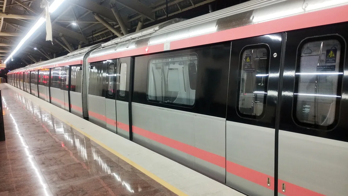
For buyers exploring South-West Bengaluru, Kengeri and its adjacent extensions around Challaghatta offer one of the most compelling value propositions in the city. Unlike many peripheral growth corridors that rely on speculative infrastructure promises, Kengeri has fixed-rail mass transit running today: the operational Purple Line of Namma Metro.
From Kengeri or Challaghatta, an air-conditioned metro train delivers you to Majestic in 25 minutes, MG Road in 35 minutes, and ITPL/Whitefield in approximately 70 minutes without switching lines. Combined with the 10-lane Bengaluru-Mysuru Expressway and the NICE Ring Road intersection, regional connectivity is robust.
Yet, a metro line does not cure an irregular land title, eliminate domestic water scarcity, or widen a congested interior access lane. When evaluating property here, you must run four critical checks before placing advance deposits.
1. Deconstructing the Metro Corridor: Kengeri to Challaghatta
The western end of the Purple Line operates through three critical stations:
[ Nayandahalli / RR Nagar ] ──► [ Jnanabharathi ] ──► [ Pattanagere ] ──► [ Kengeri Bus Terminal ] ──► [ Kengeri Town ] ──► [ Challaghatta Terminal ]
                                                                                                                          │
                                                                                                                   (NICE Road Junction)
| Station Node | Immediate Vicinity Character | Primary Commute Benefit | Last-Mile Reality |
|---|---|---|---|
| Kengeri Bus Terminal | High-density urban multi-modal hub connecting BMTC and KSRTC buses | Direct connectivity to central Bengaluru and interstate bus routes | Heavy pedestrian and vehicular cross-traffic; noise on Mysore Road frontage |
| Kengeri Town / Railway | Historic township with established local markets, schools, and hospitals | Proximity to Kengeri suburban railway station for regional trains | Narrow interior streets; older layout infrastructure requiring careful parking checks |
| Challaghatta Terminal | Terminal station situated near NICE Road interchange and Rajarajeshwari Medical College | Rapid vehicular egress to Electronic City and Bannerghatta via NICE Road | Emerging semi-peripheral pocket; requires private vehicle or auto for interior layout access |
2. The Last-Mile Commute and Junction Choke Points
While metro travel times are fixed and reliable, the daily friction often begins the moment you leave the station exit gate.
The Kengeri Bus Terminal Bottleneck
Where Mysore Road meets the Kengeri suburban bus terminal and the market access road, traffic frequently bottlenecks: - Bus Stacking: Intra-city BMTC buses, intercity KSRTC coaches, and auto-rickshaws frequently stack across outer lanes, slowing vehicular movement. - Service Road Encroachments: Check whether access from your chosen residential project requires merging onto Mysore Road service roads where two-way traffic and street parking often compress usable carriageways.
The Peak-Hour Verification Step
Do not measure commute convenience on a quiet Sunday afternoon. Visit the property at 8:45 AM on a Wednesday: 1. Walk or drive from the project’s main security gate to the designated metro concourse entrance. 2. Note whether safe, well-lit footpaths exist, or if you will be forced to walk alongside fast-moving arterial traffic. 3. Check the availability of metro feeder buses or app-based auto-rickshaws for days with bad weather.
3. Civic Jurisdiction: BBMP vs BDA vs Gram Panchayat
Kengeri spans a wide mosaic of development eras, ranging from classic BDA layouts to newly incorporated village extensions:
1. Established BDA Layouts (e.g., Kengeri Satellite Town)
Planned primarily by the Bangalore Development Authority (BDA), these pockets feature standardized road widths, designated civic amenity (CA) sites, and designated park reservations. - Checks: Confirm the original BDA allotment letter, possession certificate, lease-cum-sale agreement, and the absolute sale deed. Ensure all property taxes have been paid to BBMP under the current Ward classification.
2. BBMP e-Khata on e-Aasthi
Any apartment or resale home within BBMP limits must possess a valid digital e-Khata generated through the e-Aasthi portal: - Ensure the property is listed under the A-Register with a verified 10-digit Property Identification Number (PID). - Beware of properties holding manual paper Khatas or non-transferable B-Register entries resulting from unapproved revenue land conversions.
3. Peripheral Pockets and Gram Panchayat History
As you move south-west towards Kumbalgodu, Kambipura, or interior Challaghatta, some older standalone plots originated under Gram Panchayat jurisdictions: - Verify that official Section 95 agricultural land conversion orders were issued by the Deputy Commissioner. - Confirm that statutory layout approval was granted by BMRDA or BDA rather than an unauthorized private developer.
4. Water Security: Cauvery Pipelines vs Deep Borewells
Water availability across Kengeri is divided into two distinct operating models:
1. Piped BWSSB Cauvery Water
Established sectors of Kengeri Satellite Town and select prominent apartment complexes receive municipal Cauvery water supply: - Request the previous 6 months of BWSSB water consumption bills from the seller or builder. - Inspect the physical water meter and verify that active water pressure flows to the sump rather than relying on a sanctioned but unpiped connection.
2. Deep Borewells and Summer Private Tankers
Peripheral communities and newer high-rises outside core municipal networks rely heavily on ground extraction: - Yield Fluctuations: Ground water levels in western Bengaluru typically sit between 600 and 1,000 feet. In dry summer months (March to May), borewell output can decline significantly. - Apartment Maintenance Costs: Check the apartment owners association’s monthly financial statements. Ask specifically about private water tanker expenditures during summer. In tanker-reliant complexes, monthly maintenance fees can surge by ₹1,000 to ₹2,500 per unit during drought spells.
5. Environmental Diligence: Vrishabhavathi Valley & Lake Buffers
Western Bengaluru features vital drainage networks that must be respected during statutory vetting: - Vrishabhavathi River Basin: Confirm that the property is situated at an adequate elevation and distance from the Vrishabhavathi valley stream network to avoid seasonal odor issues or runoff during flash floods. - 30-Meter Lake Buffer: Under National Green Tribunal (NGT) rules, ensure no portion of the building, clubhouse, or boundary wall infringes upon the mandatory 30-meter buffer zone around local water bodies (such as Kengeri Lake or Kommaghatta Lake). - Stormwater Drains (Rajakaluves): Demand that your property lawyer map the village survey map (Tippani) against BBMP master plan stormwater layers to guarantee no natural drain has been covered or altered.
Due Diligence Checklist for Kengeri & Challaghatta
Before committing financial advance payments on an apartment, plot, or villa in the Kengeri metro belt, verify these 8 statutory points:
Frequently asked questions
No. Metro access solves the fixed-rail journey, offering a predictable 25-minute transit to Majestic or 35 minutes to MG Road without traffic delays. However, your daily commute also includes the last-mile trip from your apartment gate to the station concourse. If that stretch suffers from narrow service roads, poor pedestrian walking infrastructure, or congestion near the Kengeri bus terminal, it can add 15 to 25 minutes to your daily trip.
Kengeri is served by Namma Metro's Purple Line, not the Green Line. The Purple Line runs east-west across Bengaluru, connecting Challaghatta and Kengeri on the western end to Whitefield (Kadugodi) on the eastern end, passing through central hubs like Vijayanagar, Majestic, Vidhana Soudha, and MG Road. To reach the Green Line (North-South corridor), passengers change trains at the Nadaprabhu Kempegowda (Majestic) interchange.
Kengeri is a distinct, established urban and suburban township at the outer boundary of South-West Bengaluru, featuring organized BDA residential sectors, established educational hubs, and the Challaghatta metro terminal. Mysore Road represents the broader commercial and industrial corridor extending outward from Nayandahalli past Kumbalgodu toward Bidadi.
Properties holding verified BBMP final e-Khatas (A-Register) on e-Aasthi or authentic BDA allotment documents are readily financed by major nationalized and scheduled commercial banks. Properties developed on unapproved revenue land or carrying manual Gram Panchayat papers without DC conversion cannot be legally mortgaged with institutional lenders.
Established sectors in Kengeri Satellite Town receive piped BWSSB Cauvery water, though water pressure and delivery schedules can vary. Newer gated developments and projects situated toward Challaghatta rely primarily on deep borewells, supplemented by private water tankers during summer months. Always inspect water utility bills before buying.
The NICE Ring Road interchange near Challaghatta provides seamless highway connectivity to South Bengaluru, allowing drivers to reach Bannerghatta Road, Kanakapura Road, and Electronic City in 25 to 40 minutes, completely bypassing central Bengaluru city traffic.
Lawyer note: This guide provides diligence principles for homebuyers and does not constitute a legal title opinion. Always engage a qualified property lawyer to inspect original parent deeds, encumbrance certificates, and sanctioned building plans for your specific property.
CA note: Real estate transactions involve stamp duty, property registration taxes, TDS deduction under Section 194-IA, and capital gains considerations. Consult a certified chartered accountant for transaction-specific financial counsel.
Sources
Checked 17 Nov 2026.
- Bangalore Metro Rail Corporation Limited (BMRCL) — Official Purple Line alignment and operational schematic route map: https://english.bmrc.co.in/schematic-route-map/
- Karnataka Land Records (Bhoomi) — Village survey maps, RTC records, and Akarband boundaries: https://landrecords.karnataka.gov.in/
- Greater Bengaluru Authority (e-Aasthi) — Digital property records and e-Khata verification: https://gbaeaasthi.karnataka.gov.in/
- Bangalore Development Authority (BDA) — Layout planning standards and allotment regulations: https://bdabangalore.org/
- Bangalore Water Supply and Sewerage Board (BWSSB) — Cauvery Stage 5 water network coverage: https://bwssb.karnataka.gov.in/