Short answer: Buying near a lake in Bengaluru can be fine, but only after three checks on the specific property: its distance from the lake's revenue boundary or the drain, the survey map that proves where that boundary is, and the date the plan was approved. Lake buffers became size-based on 18 Feb 2026, and drain encroachments are still being cleared.
- Lake buffers now run from 0 m to 30 m by lake size (Act 19 of 2026), measured from the revenue boundary, so you need the lake's area in acres.
- Primary, secondary and tertiary drains carry 50 m, 25 m and 15 m buffers under RMP-2015, as cited by the Supreme Court in 2019.
- Pull the official maps: SSLR's Revenue Maps Online has lake survey maps and rajakaluve survey details by village.
- Encroachments are still being removed. Of 4,106 drain encroachments identified, 2,395 had been cleared by October 2025.
- Use the distance, document, date test below on any property near water.
- What are the buffer rules near lakes and drains?
- The distance, document, date test (our framework)
- Which maps should you pull?
- What happens to buildings that encroach?
- What questions should you ask the builder or seller?
- What mistakes do buyers make near lakes and drains?
- What should you do if...
- Lake and drain checklist
- Frequently asked questions
- Talk it through with acre&key
- Sources
Our flood-prone areas map tells you which parts of the city flood. This page is narrower and more practical: you've found a flat or plot near a lake or a big drain, and you want to know whether it's legally and physically safe to buy.
What are the buffer rules near lakes and drains?
Lakes. Karnataka Act 19 of 2026, in force from 18 Feb 2026, replaced the flat 30 m lake buffer with one based on the tank's area, measured from its revenue boundary (Bill as passed):
| Tank area | Buffer |
|---|---|
| Up to 0.05 acre | 0 m |
| Above 0.05 to 0.10 acre | 1 m |
| Above 0.10 to 1 acre | 3 m |
| Above 1 to 10 acres | 6 m |
| Above 10 to 25 acres | 12 m |
| Above 25 to 100 acres | 24 m |
| Above 100 acres | 30 m |
Inside the buffer, construction is barred except approved public utilities. The National Green Tribunal took suo motu notice of the change, according to the Times of India (news), so the rule could change again.
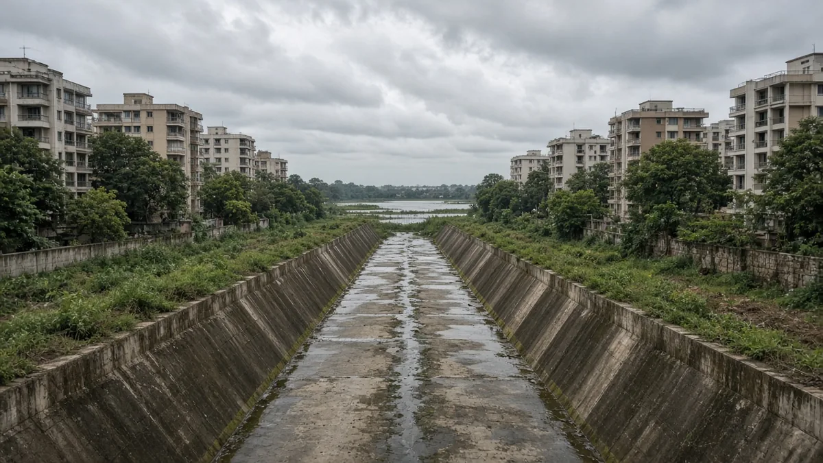
Drains. The Supreme Court's judgment of 5 Mar 2019 referred to the RMP-2015 buffers of 50 m from primary drains (rajakaluves), 25 m from secondary drains and 15 m from tertiary drains (judgment). The judgment describes the measurement two ways in different passages, from the drain's edge and from its middle, which matters near the line (worked example 2).
The distance, document, date test (our framework)
| Test | Question | What answers it | Stop sign |
|---|---|---|---|
| Distance | How far is the building or plot from the lake's revenue boundary, or from the drain? | Approved plan with the buffer line; a surveyor's measurement | Inside the buffer for that lake size or drain type |
| Document | Which official map shows where the boundary is? | SSLR lake survey map; rajakaluve survey details; village cadastral map | No one can show you the boundary on an official map |
| Date | When was the plan approved, and under which buffer rule? | Plan approval letter; RERA documents | Approved before 18 Feb 2026 but built to a smaller buffer than the 30 m then in force |
Pass all three and the water's edge is a view, not a legal risk. Fail one and it goes to your lawyer before any money moves.
Which maps should you pull?
- Lake survey maps. The Survey Settlement and Land Records department's Revenue Maps Online has a "Lake (Survey)" section listing lake survey maps by district, taluk, hobli, village and survey number, including Bengaluru Urban.
- Rajakaluve survey details. The same portal has a "Raj Kalve Survey Details" section.
- Village cadastral maps. Also on Revenue Maps Online, by village.
- Land records. The RTC for the property's and the lake's survey numbers on Bhoomi tells you the lake's recorded extent.
- The approved plan. It should show the buffer line, and the building should sit behind it.
Phone apps that overlay survey boundaries are useful for a first look, but a survey map and a licensed surveyor's measurement are what your lawyer will rely on.
Worked example 1: same distance, different answers
Illustrative. Two plots, each with its boundary 15 m from the revenue boundary of a nearby lake.
| Plot A | Plot B | |
|---|---|---|
| Lake area (from the RTC) | 3 acres | 60 acres |
| Buffer under Act 19 of 2026 | 6 m | 24 m |
| Plot boundary from the lake | 15 m | 15 m |
| Result | Outside, with 9 m to spare | Inside by 9 m |
| Under the old 30 m rule | Inside by 15 m | Inside by 15 m |
Plot A became buildable on paper in February 2026. Plot B is still inside the buffer. Neither answer is possible without the lake's area from revenue records, and if the NGT changes the rule, Plot A's position could change too.
Worked example 2: edge or centre?
Illustrative. A building 22 m from the edge of a secondary drain that's 12 m wide (so 28 m from its centre line). Secondary drain buffer: 25 m.
| Reading | Buffer runs to | Building at | Result |
|---|---|---|---|
| From the drain's edge | 25 m from the edge | 22 m from the edge | Inside by 3 m |
| From the drain's centre | 25 m from the centre (19 m from the edge) | 28 m from the centre | Outside by 3 m |
When a building sits this close to the line, the reading decides the answer. Ask your lawyer which applies, and check how the approving authority drew the buffer on the plan.
What happens to buildings that encroach?
They can be demolished. Figures the Deputy Chief Minister tabled in the Legislative Assembly, as reported in October 2025, showed 4,106 stormwater-drain encroachments identified, of which 2,395 had been removed, 1,325 were still under survey, 198 were in court and 188 were being cleared, leaving 1,711 uncleared (news report).
Worked example 3: what those numbers tell a buyer
| Status | Count | Share of 4,106 |
|---|---|---|
| Removed | 2,395 | 58.3% |
| Still uncleared (survey, court, in progress) | 1,711 | 41.7% |
More than four in ten identified encroachments were still standing at that point. A building that has stood for years next to a drain isn't proof it's legal. It may simply not have been reached yet.
What questions should you ask the builder or seller?
- What's the lake's survey number and area in acres, and which buffer applies?
- Where's the buffer line on the approved plan, and how far is the building behind it?
- Was the plan approved before or after 18 Feb 2026, and under which buffer?
- Where's the nearest primary or secondary drain, and was its buffer measured from the edge or the centre?
- Has the property ever appeared on an encroachment list or received a notice?
- Where does the site's stormwater go?
- Did water enter the basement or approach road in the last monsoon?
Questions 6 and 7 are about flooding, not law. A property outside every buffer can still sit in a low spot. Visit after heavy rain.
What mistakes do buyers make near lakes and drains?
- Quoting the old 30 m lake rule. It's size-based now.
- Not getting the lake's area. Without it, the buffer can't be worked out.
- Trusting a phone app over a survey map. Apps are a first look only.
- Assuming an old building is legal. Encroachment clearance is still under way.
- Ignoring the approval date. A plan approved before February 2026 was meant to keep 30 m.
- Checking the law but not the ground. Legal distance doesn't keep a basement dry.
What should you do if...
...the property is inside a buffer? Treat it as a Stop. Our legal checks guide explains why it's not something a seller can fix.
...it's just outside the new lake buffer but inside the old 30 m? Ask your lawyer about the risk while the NGT matter is pending, and check the approval date.
...no one can show you the boundary on a map? Pay for a licensed surveyor before you pay a token.
...the building flooded last monsoon? Ask what was done about it, and check your insurance. Our answer on home insurance for a new flat covers what to ask.
Lake and drain checklist
- [ ] Lake's survey number and area in acres from the RTC
- [ ] Buffer worked out from the 2026 table
- [ ] Lake survey map pulled from Revenue Maps Online
- [ ] Rajakaluve survey details checked for nearby drains
- [ ] Buffer line shown on the approved plan; building behind it
- [ ] Plan approval date noted against 18 Feb 2026
- [ ] Edge vs centre reading confirmed by your lawyer for drains
- [ ] No encroachment notice on the property
- [ ] Site visited after heavy rain
- [ ] Insurance cover for flood confirmed in writing
Near-water properties raise water-supply questions too: see Bengaluru apartment water problems: 15 questions. For plots, read buying a plot in Bengaluru. If the building is ready, check its OC. The rest of the pre-purchase list is in 100 things to know before buying.
Frequently asked questions
It can be, if the building is outside the lake's buffer, the boundary is shown on an official survey map, and the plan was approved under the rule in force at the time. Check flooding separately by visiting after heavy rain. A lawyer should confirm the buffer for the specific property.
Since 18 February 2026, under Karnataka Act 19 of 2026, it depends on the lake's size: 0 m for the smallest tanks, 6 m for 1 to 10 acres, 12 m for 10 to 25 acres, 24 m for 25 to 100 acres and 30 m above 100 acres, measured from the revenue boundary.
A rajakaluve is a primary stormwater drain. RMP-2015, as cited by the Supreme Court in 2019, sets a 50 m buffer for primary drains, 25 m for secondary and 15 m for tertiary. The judgment describes the measurement from both the edge and the middle, so ask your lawyer which applies.
Get the lake's survey number and area from the RTC on Bhoomi, then pull the lake survey map from SSLR's Revenue Maps Online. Compare it with the approved plan's buffer line. If the building is close to the line, ask a licensed surveyor to measure the distance on the ground.
Yes, if it encroaches on the drain or its buffer. Figures tabled in the Legislative Assembly and reported in October 2025 showed 4,106 drain encroachments identified, 2,395 removed and 1,711 still uncleared. An old building isn't proof it's legal; it may not have been reached yet.
That's a question for your lawyer. What you can check is the plan's approval date. A plan approved before 18 February 2026 was approved under the flat 30 m rule, so a building closer than 30 m to the lake then needs an explanation. The NGT has also taken notice of the change.
No. The buffer is a legal line, not a flood line. Low-lying land near a lake or drain can flood whether or not it's inside the buffer. Visit after heavy rain, ask residents about the last monsoon, and check where the site's stormwater goes.
Lawyer note: Buffer rules and their application to a specific property are legal questions. This page is general information, not legal advice. Consult a property lawyer before paying, signing or registering.
Sources
Checked 18–19 Oct 2026.
- Karnataka Tank Conservation and Development Authority (Amendment) Bill, as passed (Act 19 of 2026): https://kla.kar.nic.in/council/house/bills/156/33E.pdf
- Times of India, new law reduces lake buffer zones; NGT notice (news): https://timesofindia.indiatimes.com/city/bengaluru/bengaluru-activists-slam-new-law-that-reduces-lakes-buffer-zones/articleshow/128685669.cms
- Supreme Court judgment, 5 Mar 2019 (drain buffers): https://api.sci.gov.in/supremecourt/2016/16740/16740_2016_Judgement_05-Mar-2019.pdf
- SSLR, Revenue Maps Online (lake survey maps, rajakaluve survey details, cadastral maps): https://landrecords.karnataka.gov.in/service3/
- Bhoomi land records: https://landrecords.karnataka.gov.in/
- Stormwater-drain encroachment figures tabled in the Legislative Assembly, reported 26 Oct 2025 (news): https://bangaloremirror.indiatimes.com/bangalore/civic/1700-encroachments-block-city-drains-flood-woes-deepen/articleshow/124818331.cms