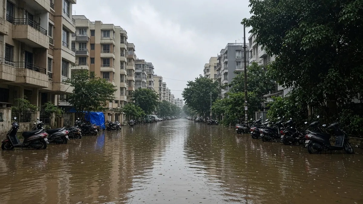
Short answer: Flood-prone areas in Bengaluru are tracked as points, not neighbourhoods. In April 2026, the five city corporations had 101 flood-prone locations (48 West, 24 South, 20 East, 6 North, 3 Central), and 52 were still unfixed. Before buying, check the street, the nearest lake and drain buffers, and the site after heavy rain.
- Bengaluru's flood data is a list of vulnerable points, not a parcel-level flood map. A point on a road isn't a verdict on every building around it.
- 101 flood-prone locations across the five corporations as of April 2026, per TNIE; the GBA set 49 for fixing this year. Older lists counted 209 to 226 points on BBMP's zones.
- Lake buffers changed on 18 Feb 2026. Karnataka Act 19 of 2026 replaced the flat 30 m buffer with buffers of 0 m to 30 m based on the lake's size, measured from its revenue boundary. The NGT has taken notice of the change.
- A legal buffer is a building rule, not a flood guarantee. Water doesn't read the amendment.
- Run the four-layer check: city list, lake buffer, drain buffer, and the site itself after rain.
- Which areas of Bengaluru are flood-prone in 2026?
- Is there an official flood map of Bengaluru?
- What are the lake buffer zone rules in Bengaluru now?
- What is the rajakaluve buffer?
- How do you check whether a specific flat is flood-prone? The four-layer check
- What questions should you ask the builder about flooding?
- What mistakes do buyers make about flood risk?
- What to do if...
- Flood check checklist
- Frequently asked questions
- Talk it through with acre&key
- Sources
Every monsoon the same clips come back: cars stalled at Silk Board, a basement being pumped out near a lake. And every year a few buyers tell us they wish they'd asked about water before they booked. This page isn't here to write off any part of the city. It shows what the official data says, how old it is, where it disagrees with itself, and how to check one specific address.
Which areas of Bengaluru are flood-prone in 2026?
The most recent count we could find covers the five city corporations under the Greater Bengaluru Authority (GBA). As of April 2026, there were 101 flood-prone locations, of which 49 had been made monsoon-ready and 52 were still pending (The New Indian Express, 11 Apr 2026).
| City corporation | Flood-prone locations (Apr 2026) | Share of 101 |
|---|---|---|
| Bengaluru West | 48 | 47.5% |
| Bengaluru South | 24 | 23.8% |
| Bengaluru East | 20 | 19.8% |
| Bengaluru North | 6 | 5.9% |
| Bengaluru Central | 3 | 3.0% |
| Total | 101 | all |
Source: TNIE, citing information available with the paper. We haven't seen the official list itself.
The GBA's pre-monsoon circular set 49 locations to be addressed in 2026 and named Panathur 'S' Cross, Silk Board, Madiwala and Rajarajeshwari Nagar among those flagged (The Hindu). In April 2026 inspections, officials also reviewed works at Kendriya Vihar and Kogilu Junction in Yelahanka, Tata Nagar, Hebbal Junction, Manyata Tech Park, HBR Layout, Geddalahalli, Nagawara Junction, Sai Layout and Silk Board (TNIE; The Hindu).
A location on that list is usually a junction, a road stretch or an underpass. It tells you where water collects. It doesn't tell you that a building 400 m away floods.
Why do different sources give 101, 209 and 226?
Because they're different lists, made on different boundaries, in different years.
| Count | What it was | Year | Source |
|---|---|---|---|
| 226 | Flood-prone locations in a KSNDMC report to BBMP | 2023 | Bangalore Mirror, 12 Apr 2023 |
| About 209 to 210 | Vulnerable locations on the stormwater drain department's list | 2025–2026 | News reports; we haven't seen the list |
| 101 | Flood-prone locations across the five new corporations | Apr 2026 | TNIE |
We can't reconcile these exactly. Likely reasons: points fixed between lists, different definitions of "vulnerable" vs "flood-prone", and the move from BBMP's zones to five corporations. The practical lesson: an area missing from the latest list isn't proof it's dry, and an area on an old list may have been fixed.
The 2023 KSNDMC report also showed how little rain some points need: Panathur Main Road at 1 cm, the Kalyan Nagar ring road stretch at 3 cm, KR Puram and Mahadevapura at 4 cm (same report). Those were road points then. Some may have been fixed since.
Is there an official flood map of Bengaluru?
There's an official map of points, not a buyer-friendly parcel map. KSNDMC periodically updates the flood-vulnerable areas (FVA) for the city, and the state's Varunamitra portal shows them on a map (KSNDMC hydrology). KSNDMC also runs an urban flood model built with IISc, fed by telemetric rain gauges, weather stations and water-level sensors, and pushes rain alerts through the Bengaluru Megha Sandesha app (KSNDMC urban flood monitoring).
Use Varunamitra to see whether a vulnerable spot sits on your approach road. Use the app during the monsoon. Neither will tell you whether a particular basement floods.
Note on official portal availability: The state government's Varunamitra server experiences periodic downtime and SSL certificate timeouts. For a complete local breakdown of the 101 vulnerable spots, lake buffer distances, and rajakaluve rules, read the East Bengaluru flood risk advisory on acre&key Answers.
We'll add an interactive map of the 2026 points over the new corporation boundaries once the official location data is available in a form we can map accurately. We'd rather wait than draw dots from news copy. Meanwhile, our ward and city corporation lookup tells you which corporation a flat sits in.
What are the lake buffer zone rules in Bengaluru now?
They changed in February 2026, and most guides still quote the old 30 m.
The Karnataka Tank Conservation and Development Authority (Amendment) Act, 2025, notified as Karnataka Act 19 of 2026 on 18 Feb 2026 and in force at once, rewrote Section 12. The no-construction buffer now depends on the tank's area and is measured from its revenue boundary (Bill as passed, Karnataka Legislature; Times of India).
| Tank area | Buffer from revenue boundary |
|---|---|
| Up to 0.05 acre | 0 m |
| Above 0.05 to 0.10 acre | 1 m |
| Above 0.10 to 1 acre | 3 m |
| Above 1 to 10 acres | 6 m |
| Above 10 to 25 acres | 12 m |
| Above 25 to 100 acres | 24 m |
| Above 100 acres | 30 m |
Inside the buffer, construction and commercial, recreational or industrial activity are barred, except approved public utilities such as roads, bridges, pipelines, sewage lines and STPs that don't block the lake's inflow or outflow.
Two cautions. The Times of India reported that the National Green Tribunal took suo motu notice of the amendment and issued notices to the state, so the position could change. And a smaller legal buffer doesn't make low land near a lake any drier.
Worked example 1: how much the new law changes the buffer
Two flats, each 18 m from a lake's revenue boundary.
| Flat A | Flat B | |
|---|---|---|
| Lake size | 8 acres | 40 acres |
| Old buffer (uniform) | 30 m: flat inside | 30 m: flat inside |
| New buffer (Act 19 of 2026) | 6 m: flat outside by 12 m | 24 m: flat inside by 6 m |
So you can't answer "is this flat in the buffer?" without the lake's area in acres from revenue records. That's a step most buyers, and most checklists, skip. Ask your lawyer to pull the tank's survey details along with the project's title documents.
Buffer rules are general information. Confirm with a property lawyer for any specific property.
What is the rajakaluve buffer?
A rajakaluve is a primary stormwater drain. Buffers along drains come from the zoning regulations of the Revised Master Plan 2015. The Supreme Court's judgment of 5 March 2019 set aside the NGT's 2016 general direction for wider buffers and referred to the RMP-2015 figures (Supreme Court judgment):
| Drain | RMP-2015 buffer | NGT 2016 direction (set aside) |
|---|---|---|
| Primary (rajakaluve) | 50 m | 50 m |
| Secondary | 25 m | 35 m |
| Tertiary | 15 m | 25 m |
The 2026 tank amendment covers lakes, not drains. We found no later change to the drain buffers, but we haven't read the current zoning regulations end to end, so have your lawyer confirm.
Worked example 2: edge or centre?
The Supreme Court judgment quotes the drain buffer in two ways in different passages: once from the drain's edge, once from its middle. On a 20 m wide primary drain, that's a 10 m difference:
- Measured from the edge: the buffer line is 50 m from the edge, or 60 m from the centre.
- Measured from the centre: the buffer line is 50 m from the centre, or 40 m from the edge.
A building 45 m from the drain's edge is inside the buffer on the first reading and outside it on the second. If a project sits near that line, it's a question for your lawyer before you pay anything.
How do you check whether a specific flat is flood-prone? The four-layer check
No single source answers it, so stack four checks. We use this order with buyers because each layer costs a bit more effort than the one before.
Layer 1: the city list (10 minutes). Open Varunamitra's FVA map. Is a vulnerable spot on the approach road, the nearest junction or the underpass you'd use daily? Note it. A flooded approach road can strand you even if the building stays dry.
Layer 2: the lake buffer (needs your lawyer). Find the nearest lake. Get its area in acres and the flat's distance from its revenue boundary. Read the buffer off the 2026 table. Then ask: was the project approved before or after 18 Feb 2026, and does the approved plan rely on the reduced buffer?
Layer 3: the drain buffer (needs the plan). Find the nearest primary or secondary drain on the approved layout or the RERA documents. Ask the builder to mark the buffer line on the approved plan, and ask your lawyer whether it's measured from the edge or the centre.
Layer 4: the site (one morning). Visit the morning after heavy rain. Look at: - the approach road and the nearest junction - the basement ramp: does it slope down from road level, and is there a hump or a gate? - the ground floor plinth: is it above the road, or below it? - stains on compound walls, sandbags, or pumps stored near the basement - what security staff, shopkeepers and residents say about which roads flood, and for how long
If Layers 1 to 3 are clean and Layer 4 looks bad, believe Layer 4.
You can also check the project's location and documents on RERA; our guide on how to check any project on RERA Karnataka shows where they sit. And our Bengaluru property legal checks, from title to OC puts the buffer question in the wider legal review.
What questions should you ask the builder about flooding?
- Has this site or its approach road ever flooded? When?
- How far is the nearest lake's revenue boundary, and what's the lake's area?
- Was the plan approved under the old 30 m or the new size-based lake buffer?
- Where's the nearest primary or secondary drain, and where's its buffer line on the approved plan?
- How is the basement protected: ramp hump, gate, sump pumps, backup power?
- Where does the site's stormwater go, and does it connect to a city drain?
- Is there a rainwater recharge system, and who maintains it after handover?
Put the answers in an email so you have them in writing. Our checklist before paying the token has the rest of the pre-booking questions.
What mistakes do buyers make about flood risk?
- Treating a locality as all good or all bad. Risk is street-level and depends on height and distance from water.
- Relying on the old 30 m lake buffer. It changed on 18 Feb 2026.
- Assuming a point missing from a list means it's fixed. Lists change boundaries and definitions.
- Visiting only on sunny weekends. A dry-season visit tells you almost nothing about drainage.
- Ignoring the approach road. A dry flat on a flooded road is still a flat you can't reach.
- Accepting "it's never flooded" verbally. Ask in writing and ask the neighbours.
What to do if...
...the flat you like is near a vulnerable point? Look at the gap in height between the building and the point, and check whether works there were completed. Visit after rain before deciding.
...the project relies on the reduced lake buffer? Ask your lawyer about the risk while the NGT matter is pending, and whether the approval date falls before or after 18 Feb 2026.
...the basement is below road level with no hump or gate? Ask the builder in writing what protection is planned. Treat the basement as at risk until you see it.
...you've already booked and the area flooded this year? Document it with photos and dates, raise it with the builder and the residents' group, and speak to a lawyer if it touches what was promised in the agreement.
...you want insurance against flood damage? Ask the insurer in writing how they treat a property near a lake or drain. Our answer on home insurance for a new flat covers the basics.
Flood check checklist
- [ ] Varunamitra FVA map checked for the approach road and nearest junction
- [ ] Nearest lake identified, with its area in acres and the revenue boundary distance
- [ ] Lake buffer read from the 2026 table; plan approval date noted
- [ ] Nearest primary or secondary drain found on the approved plan
- [ ] Drain buffer line marked; edge vs centre confirmed by your lawyer
- [ ] Site visited the morning after heavy rain
- [ ] Basement ramp, plinth level and stains checked
- [ ] Residents and security asked about flooding
- [ ] Builder's answers on flooding received in writing
- [ ] Megha Sandesha app installed for monsoon alerts
For the other area checks, see the Bengaluru metro map for homebuyers. Buying for the first time? Our first-time home buyer guide to Bengaluru puts flood checks in the wider picture. To score a shortlist side by side, try the property risk assessment calculator.
Frequently asked questions
As of April 2026, TNIE reported 101 flood-prone locations across the five city corporations: 48 in the West corporation, 24 South, 20 East, 6 North and 3 Central. Across the city, 52 were still unfixed; the report didn't split those by corporation. These are road and junction points, not whole areas, so check the specific street and visit after heavy rain.
Yes, for points. KSNDMC updates the flood-vulnerable areas, and the state's Varunamitra portal shows them on a map. It isn't a parcel-level map, so it won't tell you whether a particular building floods. Combine it with lake and drain buffer checks and a site visit after rain.
Since 18 Feb 2026, Karnataka Act 19 of 2026 sets lake buffers by the tank's size, measured from its revenue boundary: from 0 m for the smallest tanks, through 6 m for 1 to 10 acres and 24 m for 25 to 100 acres, up to 30 m above 100 acres. The NGT has taken notice of the change.
A rajakaluve is a primary stormwater drain. The buffers referred to in the Supreme Court's 2019 judgment, from the Revised Master Plan 2015, are 50 m for primary drains, 25 m for secondary and 15 m for tertiary drains. The judgment quotes the measurement from both the edge and the centre, so confirm with a lawyer.
Use four layers: check Varunamitra's vulnerable spots near the approach road, work out the lake buffer from the lake's size and distance, find the drain buffer on the approved plan, and visit the morning after heavy rain. If the site visit looks bad, trust it over the paperwork.
No. The buffer is a legal limit on construction, not a measure of how water behaves. Low land near a lake can flood whatever the buffer says. The 2026 change reduced buffers for most lakes under 100 acres, so check the ground and the drainage, not just the rule.
It can. Lenders and insurers make their own assessment of a property, and flood exposure can be part of it. Ask your bank and your insurer directly how they treat a property near a lake or drain, and get the answer in writing before you commit.
The latest count we found is 101 across the five city corporations in April 2026, with 52 still unfixed (TNIE, news). Older lists gave 226 in 2023 and about 209 more recently. They use different boundaries and definitions, so they can't be compared directly.
Lawyer note: Lake and drain buffer points on this page are general information, not legal advice. Confirm with a property lawyer before you pay, sign or register.
Sources
Checked 19 Oct 2026.
- The New Indian Express, 52 of 101 flood-prone locations yet to be fixed, 11 Apr 2026 (news): https://www.newindianexpress.com/cities/bengaluru/2026/Apr/11/52-of-101-flood-prone-locations-in-bengaluru-yet-to-be-fixed-before-monsoon
- The New Indian Express, ACS inspection of flood-prone locations, 11 Apr 2026 (news): https://www.newindianexpress.com/cities/bengaluru/2026/Apr/11/complete-pending-flood-works-in-bengaluru-by-may-30-or-face-suspension-acs-tushar-girinath
- The Hindu, GBA directs five corporations on pre-monsoon preparedness, 2026 (news): https://www.thehindu.com/news/national/karnataka/gba-directs-five-corporations-to-step-up-pre-monsoon-preparedness/article70816622.ece
- The Hindu, monsoon readiness inspection, 2026 (news): https://www.thehindu.com/news/cities/bangalore/monsoon-readiness-tushar-giri-nath-issues-instructions-for-flood-prone-areas-in-bengaluru/article70847621.ece
- Bangalore Mirror, KSNDMC report of 226 flood-prone locations, 12 Apr 2023 (news): https://bangaloremirror.indiatimes.com/bangalore/others/1-cm-of-rain-can-cause-floods-in-bengaluru/articleshow/99416059.cms
- Varunamitra (Govt of Karnataka), vulnerable spots map: https://varunamitra.karnataka.gov.in/Default/Index?service=VulnerableSpots
- KSNDMC, hydrology activities: https://ksndmc.org/en/Activities/Hydrology
- KSNDMC, urban flood monitoring: https://ksndmc.org/Content/Documents/General/Urban%20Flood%20Monitoring.pdf
- Karnataka Legislature, Karnataka Tank Conservation and Development Authority (Amendment) Bill 2025, as passed (enacted as Act 19 of 2026): https://kla.kar.nic.in/council/house/bills/156/33E.pdf
- Times of India, new law reduces lake buffer zones; NGT notice (news): https://timesofindia.indiatimes.com/city/bengaluru/bengaluru-activists-slam-new-law-that-reduces-lakes-buffer-zones/articleshow/128685669.cms
- Supreme Court of India, judgment of 5 Mar 2019 (Civil Appeal on NGT buffer directions): https://api.sci.gov.in/supremecourt/2016/16740/16740_2016_Judgement_05-Mar-2019.pdf